Two geohashing locations within cycling distance, on Saturday and today. My cup runneth over.
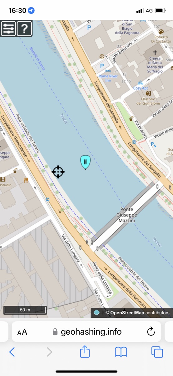
The first was very, very close to home, about 1.5km as the crow flies. It was, alas, in the middle of the Tiber, so I was prevented from reaching the location by Mother Nature. But I'm counting it a win nevertheless. I rode the Brompton, knowing it was getting late and so not worth getting the Raleigh out and happy to get a bus up the hill.
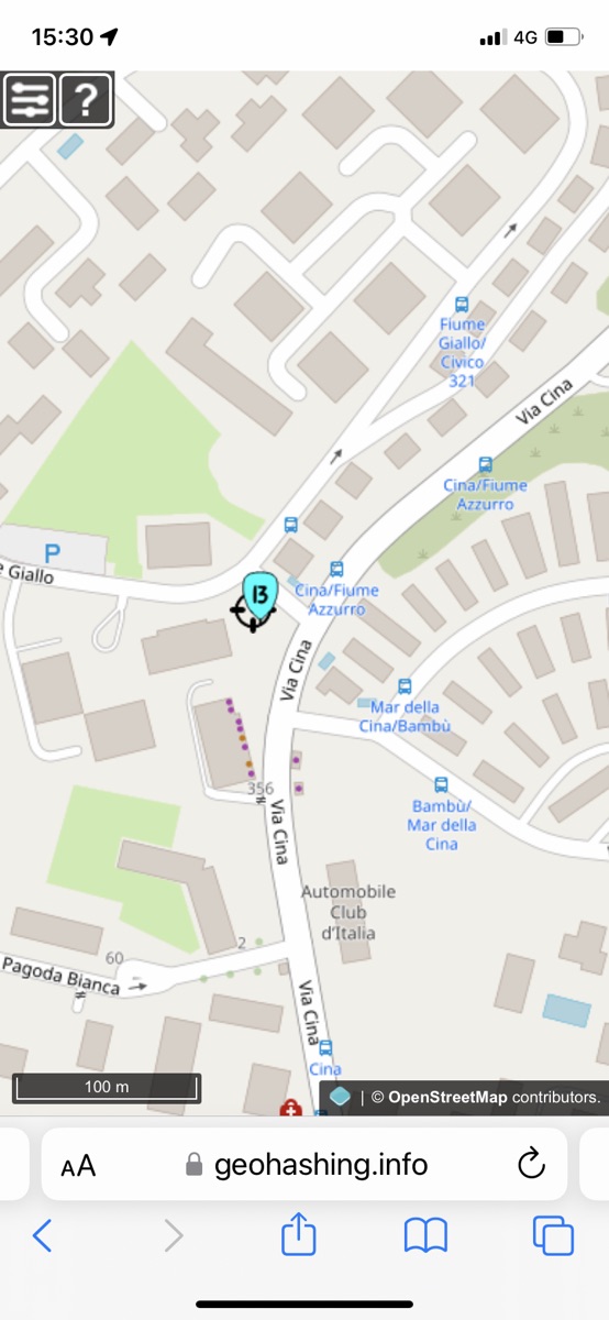
Today's was somewhat further away, near the Grande Raccordo Annulare that generally circumscribes my rides. And the day was blessed with glorious sunshine, so of course I brought the Raleigh up from its subterranean resting place. This time, there was nothing to stop me reach the location itself, save for the inherent inaccuracy of my phone's geolocation.
Two things to note. So infrequently do I set off to bag a geohash that I completely forget how to add my expedition to the wiki. No good idea how to remedy that. And having created a record on the geohashing wiki, I've no great enthusiasm for copying it all here. It might be nice to find some way to PESOS from the geohashing wiki, but it isn't urgent. I have the photos and maps and I could recreate the expedition report if I wanted to.
Webmentions
Webmentions
Webmentions allow conversations across the web, based on a web standard. They are a powerful building block for the decentralized social web.
If you write something on your own site that links to this post, you can send me a Webmention by putting your post's URL in here:
Comments